
Sparking Community Engagement: 16 Future‑Ready Strategies for Cities of All Sizes
Communities and organizations of all sizes are looking for new ways to make better decisions. In this post, we compile a broad overview of fresh trends, tools, and ideas shaping community engagement and public participation in urban planning and local policy — blending technology, inclusivity, and truly collaborative decision-making.
Many of these ideas are much more practical in larger cities and better-funded organizations. We’re looking for ideas all over the world this week. I have not tested nor used most of the specialized tools here—just looking for things to learn more about. Many are scalable and some might even work better in small groups and smaller towns.
We will look at four key themes for community engagement:
- More Places, Less Noise
- From Passive to Active Participation
- Transparency & Trust
- An Open Table
And we’ll wrap up with some thoughts on putting these community engagement ideas and tools to work in small towns and rural communities. Hint: Start small, try something, see how it works, try something else. Implementation is the watchword.
📌 Key Themes in Modern Engagement

✅ More Places, Less Noise
Local leaders are increasingly adopting digital tools to make participation more accessible and efficient. Geo-targeted tools and data-driven platforms can help focus engagement where it matters most. These platforms include mobile apps, online surveys, and virtual town halls which allow residents to engage from anywhere, removing geographic and time barriers. Geospatial consultation tools represent a particularly innovative development, enabling citizens to visualize planning proposals on maps and provide location-specific feedback, making abstract concepts more tangible through informed community engagement.
Location-Based Digital Platforms
Community members can help collect and visualize spatial data—identifying their favorite places, safety issues, or service gaps. Participatory GIS projects also use mobile data collection apps so residents contribute in real time. Our firm, Marvin Planning Consultants, regularly uses basic spatial data (geographic information systems) in our planning projects, and works to provide options for community members to express themselves through online mapping applications.
Case Study: Edinburgh Parks Redesign — In Scotland, the Edinburgh Thriving Green Spaces project used Maptionnaire, a map-based engagement platform, to gather public input on park designs. By visualizing potential layouts and amenities on interactive maps, residents can vote on their preferred options and suggest their own. Planners analyze this data within the tool or export it to any other GIS system, ensuring the redesigned park spaces better reflect community desires.
Case Study: Mesa, Arizona Development Mapping — The City of Mesa created an ArcGIS Experience Builder app that allows both staff and the public to explore active development sites across the city. This interactive map enhances internal communication about development projects while simultaneously giving residents transparent access to what’s being planned in their neighborhoods. I have been a dedicated GIS since grad school, but this project is far beyond what I have tried to do myself.
Case Study: Tampa Bay Climate Resiliency — The Tampa Bay Regional Planning Council (TBRPC) has developed an innovative augmented reality project that uses QR codes to help residents visualize climate-resilient infrastructure solutions, ranging from proposed stormwater improvements to sea-level rise mitigation features. The Augmented Reality initiative allowed community members to provide feedback on proposed developments directly at the locations where changes would occur, fostering greater public engagement.
Resource: Check out ESRI’s resources for stakeholder engagement. I’ll highlight some of their tools throughout this week’s post here.
Participatory 3D Modeling
Hands-on mapping allows communities to build actual models of landscapes or proposed developments. It’s especially effective for visualizing terrain, environmental conditions, or land use plans together.
Case Study: Turku, Finland, District Redevelopment — The University of Turku and City of Turku collaborated on a pilot project testing 3D participatory planning for the Aninkainen district redevelopment. This project integrated Maptionnaire software with Sova 3D technology, creating an engagement survey based on 3D maps where the public could comment on building designs. Sixty percent of respondents found the 3D maps easy to use, and planners noted that 3D enabled citizens to understand the plan better than traditional 2D maps, making it easier to provide precise comments—even on roofs and walls of buildings in the modeled environment.
Case Study: Park Co-Design in the Netherlands — The municipality of The Hague collaborated with The Hague University of Applied Sciences in an activity of participatory design to find evidence of the effectiveness of Virtual Reality technology in participatory urban planning processes. In the project, residents engaged in intensive co-design sessions with municipal experts using 3D modeling tools to develop competing designs for a public park. The rendered designs were then submitted to a public ballot where neighborhood residents could view and vote on their preferred option, empowering citizens in decision-making.
“Digital Twin” as a Sandbox
Digital twins—virtual, dynamic replicas of physical cities—are moving from engineering tools to public engagement platforms. This offers real-time data integration, predictive modeling, and resource management benefits for planners. Then instead of presenting residents a static rendering, planners are giving them access to the model itself.
Case Study: Helsinki Public Accessibility — Helsinki, Finland, has developed a detailed digital twin, launched in 2016, which includes data on transportation, environmental conditions, and public amenities. One standout feature is the public accessibility of the digital twin, which promotes transparency and allows residents to participate in decision-making processes. Citizens can explore virtual models of proposed developments to ensure community needs are met, while real-time data access enhances transparency and encourages public participation.
Case Study: New York City Infrastructure Optimization — New York City has implemented digital twin technology to optimize transportation networks, manage public infrastructure, and prepare for environmental challenges. Digital models accessible to the public give citizens the ability to visualize future developments like parks or community centers and offer feedback before projects begin. Columbia University, for example, has posted their Urban Hybrid Twin for urban traffic management, combining AI, edge cloud computing, and advanced communication networks. The Columbia project was sponsored by the NSF and USDOT Federal Highway Administration, back when those groups actually funded useful research and implementation.
Immersive “Future-Walking” (Extended Reality or XR)
Planners are using Virtual Reality (VR) and Augmented Reality (AR) to let people “experience” a change before a single brick is laid. This can help the community, decision-makers, and staff overcome engagement fatigue and improve understanding of complex projects.
Case Study: Mesa 2050 General Plan Mixed-Reality Installation — Mesa’s planning division partnered with consultant Logan Simpson and Arizona State University’s Resilient Visions Collaboratory to create the first immersive event experience of its kind for the city. High school students from across the city engaged with proposed future land-use designations in a 3,200-square-foot, 300-degree cylindrical, interactive mixed-reality installation. This space enabled entire groups to fully immerse themselves in the urban environments imagined within the 2050 General Plan draft, using content developed in ArcGIS Urban, SketchUp, and CityEngine.
Survey feedback in Mesa confirmed that providing an immersive, interactive experience successfully bridged the gap between complex planning documents and people’s understanding of their city’s future vision. The stakeholder engagement initiative was recognized with the American Planning Association (APA) Arizona Chapter’s Best Planning Excellence Award.
AI-Powered “Listening at Scale”
Local governments often drown in unstructured data—emails, survey comments, social media posts. As consultants, we certainly do. New AI tools have the potential to change how this community engagement feedback is processed. AI can also help structure public conversation, transform free-form input into thematic clusters, and surface key community priorities without replacing human judgment. The Planetizen website recently published a good overview, “The Dos and Don’ts of Using AI in Community Engagement for Urban Planners.” Check it out.
Case Study: Steve AI Operating System for Urban Planning — Steve, an AI Operating System, is an example of a municipal feedback aggregation tool which functions by unifying data collection, analysis, and task coordination. The platform can automatically categorize and summarize incoming public comments from town hall meetings, social media, emails, and surveys to prioritize critical conversations. Steve Chat processes diverse file formats and provides conversational queries for sentiment analysis, while supporting messages to scale from small workshops to citywide consultations. Context-aware reply suggestions help officials respond promptly, reinforcing trust in the planning process.
Case Study: Topic and Sentiment Tagging — AI platforms can use topic tagging to group feedback by subject matter (transportation, housing affordability, utilities) to determine what community members are discussing and how popular certain topics are. Sentiment tagging identifies emotional tone—positive, negative, neutral, or urgent—helping governments prioritize issues requiring immediate attention. For example, the GoVocal platform can reveal cross-question insights, such as how residents who support bike lanes are more likely to prioritize pedestrian infrastructure, and clusters unexpected themes by grouping similar ideas even when different words are used.
Case Study: Sentiment Analysis — Some organizations have used AI-supported sentiment analysis tools to help understand what people think about issues such as COVID responses and other policy matters. The Zencity platform for example processes social media posts, public comments, and other unstructured data sources to measure community sentiment at scale, enabling planners to identify emerging concerns before they become major issues.
Resources: There are a lot of nifty new startups and veterans retooling to bring AI to bear in local government (as well as in everything else). I want to give a shoutout to a couple of firms with really sharp people if you are interested in putting AI to work for you:
- Ordinal for City Planners (and the rest of the municipal functions to boot)
- Blane Canada AI (originally an economic development consultancy… taught me a lot about doing econdev in the real world)
- aLocal.ai (putting big data to work for small towns… and everybody else; I did a writeup of a recent project they did in Arizona for the APA STaR Winter 2026 newsletter)

✅ From Passive to Active Participation
Rather than expecting everyone to attend City Hall meetings, governments are bringing community engagement to where people gather—neighborhood coffee shops, libraries, and community centers. Small grassroots forums help residents feel more comfortable speaking up, particularly those from historically underrepresented groups. Gamification, immersive tech, and participatory budgeting can make engagement interactive and empowering.
Less Talking, More Listening
There is a growing move away from “Town Hall” style lectures toward structured, representative deliberation. Traditional town halls often feature officials presenting plans with limited opportunity for meaningful dialogue, creating a one-way information flow that can leave residents feeling unheard. The shift toward deliberative methods emphasizes listening sessions, focus groups, and structured conversations where residents’ voices shape the agenda rather than simply react to predetermined proposals.
Case Study: Mesa’s Immersive Engagement — Yes, Mesa again… I’m thinking of Spring Training. Instead of traditional presentation-style meetings, Mesa, Arizona created an immersive mixed-reality installation we discussed early enabled 350 high school students to engage with the city’s 2050 General Plan process. By allowing participants to experience and interact with proposed developments rather than passively listening to explanations, Mesa transformed engagement from lecture-based to experiential learning.
Citizens Assemblies
Convening groups of representative local residents who deliberate and decide on issues can revitalize traditional planning and policy bureaucracy. While the idea goes back to ancient Athens, they have been put to work all over the world, particularly in Europe. These ad hoc groups are also being put to work in a range of organizations from arts institutions to education to local parks and recreation.
Næstved, Denmark: Municipal Future Planning — The City of Næstved convened a citizens’ assembly consisting of representative citizens who were asked to make recommendations for the future of the municipality, specifically addressing city planning and urban development issues. This assembly empowered everyday residents to shape long-term municipal strategy rather than leaving these decisions solely to elected officials and planners.
Montrose, Colorado Childcare Assembly —A pilot citizens’ assembly convened in rural Montrose, Colorado, post-COVID to address pressing community issues. The assembly focused on childcare challenges and used Panelot, a lottery-based selection tool, to create 1,000 representative panels of 64 delegates mirroring the community’s diversity across age, race/ethnicity, household income, gender, political party affiliation, and local geography. Residents deliberated on eight actions curated by local childcare experts and generated 16 additional ideas. Five action ideas received over two-thirds support and were presented to the community, with local leaders publicly committing to develop implementation plans during a February 2024 celebration event.
Regional Assembly Models — Policy and planning advisors are exploring ways to integrate citizens’ assemblies at multiple scales—combining place-based community deliberation focusing on lived experience with larger regional assemblies that address geographically connected issues through professional facilitation and expert presentations. This “division of deliberative labor” would allow local assemblies to prioritize neighborhood concerns while regional assemblies tackle broader systemic challenges. The approach emphasizes building civic infrastructure from the bottom up with both local autonomy and centralized accountability. It’s an idea.
Participatory Budgeting
Along the scale of public participation in public budgeting, community members can be empowered to decide how to allocate parts of municipal budgets—often via digital or map-based tools to make decisions spatially meaningful.
Case Study: Porto Alegre’s Pioneering Model — Porto Alegre, Brazil pioneered modern participatory budgeting and has refined its model for decades, establishing it as a fruitful instrument of co-governance and community engagement. The city has achieved high results in reaching underrepresented groups whose needs are fairly represented in budget allocation. The process has increased transparency while embedding participatory budgeting into the city’s governance DNA.
Case Study: Espoo Playground Resolution — When residents of Espoo, Finland, took issue with a City-proposed playground redesign, the City invited them to contribute ideas through participatory budgeting. Using a gamified digital survey on the Maptionnaire platform, residents chose how to spend €10,000 reserved for the project. The process generated geolocated data valuable to planners while educating residents about project costs, which reduced complaints to zero and resulted in a design reflecting community wishes.
Case Study: Durham’s Five-Stage Process — Durham, North Carolina, has engaged residents from idea solicitation through budget delegation, voting, implementation, and evaluation. In their third cycle, the city collected over 600 ideas from residents across all neighborhoods, with five winners including security measures, park lighting, sustainable park improvements, pedestrian safety, and teen recreation equipment. This approach ensured residents remained involved throughout the entire project lifecycle, not just at the proposal stage.
Resource: The Participatory Budgeting Project (PBP) is a resource on this topic for communities across the US and Canada. I’m somewhat skeptical of the buzz on participatory budgeting, and ability to survive through election cycles, but I’m keeping an open mind as the process matures.
✅ Transparency & Trust
Citizens increasingly expect to see how their input influences decisions, not just submit feedback. Digital platforms now enable real-time monitoring of consultation responses, allowing governments to clarify misunderstandings and address concerns while consultations are still active. Open data dashboards display anonymized responses, demographic breakdowns, and key findings, helping build trust in the engagement process. Systems that link input to tangible outcomes help residents see how their voices matter.
Gamification & “Serious Games”
Gaming-based techniques can lighten up dry policy topics and make big ideas more engaging. Cities can use games to engage residents in local issues, rewarding participation with points which can influence which community projects receive support, or prioritize future policies and actions.
Case Study: Stockholm’s Minecraft Urban Planning — UN-Habitat and the Stockholm City Mayor used Minecraft to engage residents in urban planning processes. The game environment apparently allowed citizens to visualize and interact with proposed city designs in an accessible, familiar format that removed technical barriers to participation. This approach proved particularly effective for engaging younger residents who might not participate in traditional planning meetings. (As a now older resident, I’ve never even seen Minecraft in action, but I know the younger set is dedicated to the game.)
Case Study: Istanbul Future City VR Gaming — A real-world project for a future city of 50,000 inhabitants on the European side of Istanbul, Turkey, used VR gaming technologies as a testing ground for ideas, simulating performance and crowdsourcing concepts before physical construction. Citizens immersed themselves in the VR environment and experienced designs via four circulation modes: walking, biking, driving, and flying. The game allowed users to collect points when engaging with smart city topics such as urban farming, solar energy usage, and carbon neutrality, creating a feedback loop that helped iterate on the design. Gaming incentivized participation while the data collected provided significant feedback to shape the city’s future. (See “Gamification in Urban Planning—Experiencing the Future City,” Architecture and Planning Journal (APJ): Vol. 28: 3)
Case Study: Roblox for Children’s Urban Planning — Research explored using Roblox as a gamification tool in inclusive urban planning specifically for children to examine their ideal city concepts. This platform capitalized on children’s existing familiarity with the game to gather authentic perspectives on urban design from a demographic traditionally excluded from formal planning processes. (See “The use of gamification for participatory smart city planning of Indonesia’s new capital,” International Journal of Urban Sciences: Vol. 29, 2025.)
Case Study: Human Forest TreeCoins — HumanForest, a sustainable micro-mobility service in London, uses gamification through “TreeCoins” to drive customer motivation and engagement. This rewards-based system encourages sustainable transportation choices by connecting individual actions to environmental impact. They also focus on making the user experience fun as well as rewarding.
Transparent Decision Infrastructure
Emerging systems are being designed to bridge resident feedback and planning outputs, making it clear how community engagement input influences decisions—boosting legitimacy and trust. This can be as simple as reviewing plan drafts at a public workshop, projecting your screen on a wall and treating it like a wikithon editing session. Show your work.
Case Study: Real-Time Consultation Dashboards — Digital engagement platforms now feature live dashboards that display anonymized responses, demographic breakdowns, and key findings during active consultations. These transparent displays allow governments to monitor responses in real time, clarifying misunderstandings and addressing concerns while consultations are still open, rather than leaving participants wondering if their input was considered. ESRI offers a variety of ArcGIS Dashboards (for a price) off the rack.
Case Study: Participatory Budget Result Tracking — Here’s that participatory budgeting idea again, applied to open data and transparency. Cities can publish tracking systems that show the status of community-selected projects from proposal through implementation. Residents can monitor budget allocation, construction timelines, and project completion, creating accountability and demonstrating that participation leads to tangible outcomes.
Collaborative Policy Platforms
Open-source participatory governance platforms can support proposals, debates, and decisions for municipal issues, aligning with international best practices in civic tech. New tools can make community engagement more, well, engaging.
Case Study: Barcelona’s Decidim Platform — Barcelona developed Decidim (Catalan for “we decide”), the city’s first digital democracy tool aimed at enhancing citizen participation and democratic legitimacy. The platform, referred to as a “technopolitical project,” allows citizens to participate in municipality budgeting and other governance processes. Decidim features four key participatory spaces: processes (for creating and managing participation tools like elections or participatory budgeting), assemblies (defining groups that meet intermittently), consultations, and initiatives. The software is written in open code for transparency, increasing traceable decision-making and monitoring of proposals. Participants can navigate, create, vote, support, sign, comment, endorse, follow, sign up, and share specific proposals or content, either as individuals, collectives, or user groups. The architecture is described as “modular, scalable, easy to configure, and integrated with other tools or apps”.
Case Study: Decidim Beyond Barcelona — The Decidim platform, as an example, has been adopted by numerous cities and organizations worldwide as an open-source solution for participatory governance. (Even New York City.) Its flexible design allows municipalities to customize participation processes while maintaining transparency through open code, enabling cities to learn from each other’s implementations and continuously improve civic engagement practices. It’s free, open, and (they say) safe technology, with democratic guarantees—it just takes some time and effort.
Again, I haven’t used these tools myself (we are looking at setting up data dashboards) but these techniques have promise to 1) scale down for smaller cities and organizations, and 2) remind us today’s bleeding edge is tomorrow’s cutting edge.
Storytelling, Narrative, and Collective Visioning
Incorporating story maps and community narratives alongside technical data helps planners capture the human experience of city spaces—not just metrics. People relate to stories more than raw numbers and boring policy statements. We need to make it real.
My firm, Marvin Planning Consultants uses ESRI StoryMaps all the time for planning projects. We’re not necessarily taking full advantage of the platform’s full capabilities. We’re making progress.
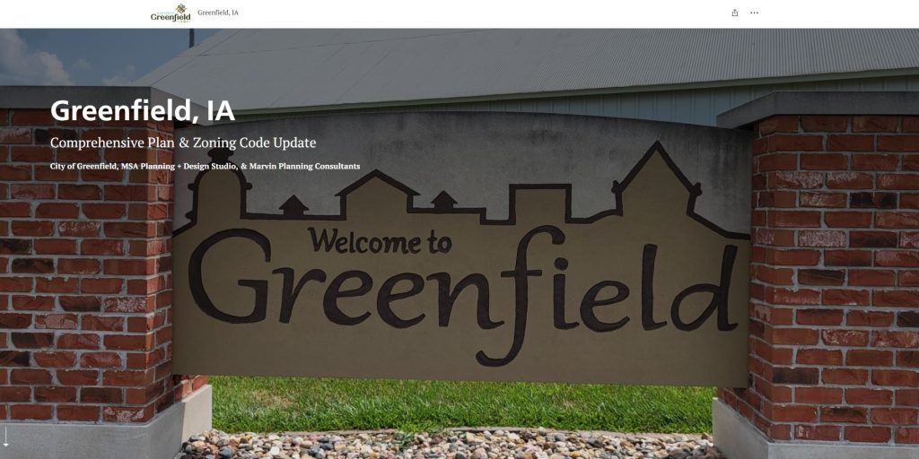
Case Study: Greenfield, Iowa, Comprehensive Plan StoryMap — On 21 May 2024, the small town of Greenfield, Iowa, was struck by an EF-4 multi-vortex tornado, resulting in the tragic loss of four lives and injuring at least 35 others. The community was devastated. In the rebuilding process, the City contracted with MSA Planning & Design Studio and MPC (that’s me!) to facilitate a comprehensive planning process, to be implemented through a concurrent zoning review and update. MSA used ESRI StoryMaps as the native venue for the new Comprehensive Plan—skip the paper, go directly to digital, to better serve the public and save costs to the public purse. City Council adopted the City of Greenfield Comprehensive Plan on 28 October 2025. (We’re working on zoning details now.)
Case Study: Nanaimo City Plan StoryMap — The City of Nanaimo, British Columbia created a Story Map to communicate their city plan, which addresses expansion for 40,000 new citizens over 25 years. The Story Map simplified a very long technical document into a readable and interactive experience that made complex planning concepts accessible to residents. By combining maps, narrative text, and visual elements, the city transformed a typically inaccessible planning document into an engaging tool for public understanding.
Case Study: Delaware Tactical Urbanism StoryMap — the Universsity of Delaware created an ESRI StoryMap, based on GIS data, showcasing how tactical urbanism projects tested ideas and transformed communities. One StoryMap documented pop-up bike lanes that became permanent infrastructure, streets transformed into vibrant cultural corridors, temporary traffic circles that calmed traffic, and on-street parking converted into portable parklets. They have worked StoryMaps into several different types of planning projects. By telling these stories with before-and-after imagery and location data, planners demonstrated the real-world impact of community-driven interventions.
Case Study: Charleston Tree Canopy Equity StoryMap — The City of Charleston designed a StoryMap to raise awareness about unequal street tree canopy coverage across neighborhoods. The narrative started by introducing the topic with data showing coverage disparities, then explained that neighborhoods with less coverage are hotter and that this correlates with socioeconomic inequity. The story map showed opportunities by identifying areas where more trees could be planted on public and private properties, then invited property owners to help the city by planting trees. This approach combined technical data with human impacts and actionable steps, making an equity issue tangible and mobilizing community response.
Case Study: Chapel Hill Educational Infrastructure StoryMap — A StoryMap created for Chapel Hill, North Carolina, explored the suitability of four potential sites for educational infrastructure. The story was divided into four slides covering different criteria: surrounding population, buses and transportation routes, drive time from fire stations, and crime data to ensure school safety. Each slide provided text and images explaining the criteria and the suitability of each site, transforming a multi-criteria decision analysis into an accessible narrative that stakeholders could follow.
Interactive Scenario Planning
Scenario planning invites planners, residents, and other stakeholders to explore several plausible futures (e.g., different patterns of growth, climate impacts, or economic shifts) and ask, “What would we do in each case?” instead of betting everything on one prediction. These futures can be aspirational (a desired end state) or exploratory (examining the implications of divergent trends and shocks). Online platforms and dashboards can be incorporated into the process help participants explore different planning scenarios (e.g., zoning changes or public space redesigns) and give feedback on trade-offs and impacts.
Case Study: Vancouver – StoryMap‑Based Scenario Communication—In Washington state, planners at the City of Vancouver are using ESRI StoryMaps interactive tool to help residents understand change in Vancouver by combining maps, historical context, and community stories. It highlights shifts in zoning, housing, and neighborhood character over time — making complex planning data more relatable and accessible to the public.
Case Study: CONNECT region Land Use Modeling—Along the North Carolina and South Carolina border, Connect Our Future used land use modeling to combine existing and projected data with economic and social behavior theorites, predicting future changes in the types and long-term impacts of land use. They used the classic CommunityViz software platform, which plugs into standard ESRI GIS models, also noting several other available models. (I’ve used CommunityViz and love it. The software is now at home at Texas A&M and is currently going through a transition from ArcGIS Dektop which ESRI is discontinuing.)
Case Study: iPlan (UW–Madison & Mass Audubon) – This free online land‑use game combines gamification with scenerio-building. Players can change zoning and development patterns and immediately see modeled impacts on jobs, housing, environment, and other indicators for any location in the contiguous U.S.. It mimics real planning trade‑offs by having virtual stakeholder groups (neighbors, businesses, environmental advocates) react differently to the same scenario, making it ideal for workshops or outreach sessions about growth choices.
Resource: Lincoln Institute of Land Policy’s Consortium for Scenario Planning offers a community of practice for practitioners, including access to technical assistance, educational resources, and a network of fellow innovators. Lincoln Land does some really amazing work, though truthfully a lot of it goes over my head.
The Consortium for Scenario Planning 2026 Conference will take place the 4th to 6th of February, 2026, at the University of Utah in Salt Lake City. Among a jam-packed agenda, Neil Homer, ONH Planning for Good, is coming over from the UK to speak on Exploratory Scenario Planning at the Small-Town Scale. That topic sounds like it needs a post all of its own. Petra Hurtado and Zhenia Dulko, on the American Planning Association (APA) staff, will speak on the upcoming 2026 APA Trend Report for Planners, a cooperative effort with Lincoln Land Institute due for release 28 January (my boss Keith Marvin is on their expert panel).

✅ An Open Table
Opening up community engagement can be easier when we step away from the dais and podium in favor of more open tables—interactive workshops, deliberative dialogues, civic juries, that sort of thing. Deliberative processes and capacity building broaden who participates — often beyond traditional stakeholders. Everyone in your community should be heard in decisions that affect them. At the same time, the best solutions emerge when different voices contribute to the process. This approach creates collective responsibility and builds trust through open dialogue, allowing community members to voice concerns and ideas candidly.
Structured Dialogue & the Art of Hosting
Structured dialogue is a facilitation approach where conversations are intentionally designed: clear purpose, agreed rules, sequenced questions, and formats that balance speaking and listening. It includes many traditions: mediation, restorative circles, deliberative democracy forums, citizen juries, facilitated workshops, etc. The choice of methods is usually pragmatic: whatever best fits the issue, time, and stakeholders, without allegiance to a particular practice.
Art of Hosting Converstions that Matter has been developed over the last 25 years or so as a specific global participatory leadership approach for designing and facilitating conversations so a group’s “collective intelligence” can shape action. This technique treats engagement as hosting conversations that matter, using circle work, World Café, Open Space, and similar methods to move from public-comment time to shared problem solving.
Art of Hosting is often described through a four‑fold practice:
- Being present – cultivating personal awareness and grounding before and during a gathering.
- Participating – engaging fully as a contributor and listener in conversations.
- Hosting – convening and holding space so others can work well together.
- Co‑creating – working with others over time to design, adapt, and sustain participatory processes.
For community engagement and planning, Art of Hosting shifts focus from “collecting input” to co‑designing responses to complex issues. The method is applicable in a wide variety of settings, from business to the public sector, across the world. (Shoutout to Dr. Jerry Nagel at Worldview Intelligence, past president of the Meadowlark Institute, for his work with Art of Hosting over the years.)
Case Study: InCommons (Minnesota) – A statewide initiative (back when I was in the Land of 10,000 Lakes) partnered with media, faith, and philanthropic organizations to train community members in Art of Hosting and then asked them to donate three days of pro‑bono hosting for local gatherings on significant social issues. Agendas were shaped around clear purpose but no predetermined outcomes, emphasizing listening, creativity, and co‑creation rather than defending prewritten plans.
Case Study: Kufunda Learning Village (Zimbabwe) – A rural “learning village” used Art of Hosting as a foundation for self‑organizing community development. Young people from the village worked to bring people together co‑designing projects and in learning spaces instead of being passive recipients of aid.
Case Study: Community practice circles – Art of Hosting fieldguides describe local “communities of practice” where residents, public servants, and nonprofit staff regularly convene to host one another’s dialogues, building a shared facilitation culture for neighborhood issues, school change, or service design.
Art of Hosting Resources: More info and links including videos, articles, and a readling list.
Place‑Keeping vs. Place‑Making
I am a big fan of placemaking. Yet a newer trend for “place‑keeping” focuses on stewarding existing social and cultural fabric and preventing displacement as part of any improvement effort, rather than assuming a place only gains value through new design. The idea is also to use placemaking as part of the public process, not just as a deliverable product.
“Place-led Community Design in Urban and Rural Settings: Two South African Case Studies”, African Journal of Landscape Architecture, Issue 6, Article7, 2023
- Thesen Islands, Knysna (urban) – A former factory site was redeveloped through environmentally sensitive placemaking followed by rigorous place‑keeping: a multidisciplinary team, continuous community participation, and long‑term management aimed at “enduring value,” not just a one‑time transformation.
- Crossways Farm Village (rural) – The development was intentionally designed around the existing, impoverished Thornhill community, training local residents as small contractors and incorporating local labor and enterprises into the project. This approach framed development as strengthening an existing place and community, rather than replacing it.[8]
Case Study: Project for Public Spaces “Placemaking as Community Development” – PPS’s work in local food systems has born fruit for local economies around the world. They have found public markets succeed when they build on existing vendors, cultures, and informal economies. For example, in Gyumri, Armenia, a community workshop led to a festival and placemaking expo that resurfaced local traditions and social life already present in the town squares.
Training & Empowerment Workshops
Capacity‑building turns community engagement from “tell us what you think” into “let’s learn together how to shape and steward this place.”
Case Study: Community First Oxfordshire placemaking model (UK) – A best‑practice framework for new development explicitly included “build and release capacity” as a step: providing voluntary and community sector support, training, and small‑grants funding so residents can organize, lead projects, and manage new community spaces over time. The Community First Oxfordshire report included a rminder from best practices: “the conversation between people who will live in the new settlements and those involved in building them should start well before the first brick is laid.”
Case Study: Digital workshop models – Guides on community engagement workshops recommend co‑designing online surveys and map‑based tools with residents at workshop sessions, which both improves the tools and trains participants in reading maps, interpreting data, and framing planning questions. In Helsinki’s national urban park project, planners and park activists co‑created survey questions together, turning “respondents” into co‑researchers.
These examples all support the “open table” idea: hosting well‑designed conversations, honoring existing place and culture, and building local skills so communities can initiate, shape, and monitor planning and policy work over time.
Bringing It All Together
There are several emerging platforms out there combining elements of digital project management with engagement technology. My firm is trying one out for a project in Missouri, from Konveio. Still evaluating how good a match the system is with the needs of our small town and rural clients (and their budgets). So far, so good.
Konveio sits in that practical middle ground many smaller communities are looking for: not another “shiny object,” but a way to make the plans you already have easier for people to read, react to, and actually use. This option integrates with ArcGIS-powered community mapping (like we discussed at the top of this post) for commenting, yet offers more map-centric tools in an easy-to-use package.
This system also makes it easier to bring documents to life. Instead of asking residents to download a 200‑page PDF and send an email into the void, Konveio lets them click right into the comprehensive plan, zoning update, or corridor study and leave comments in the margins where the words and maps actually live. (We’ll see how that works when we get there.) The platform is built around plans and policies first, engagement tools second, so the bells & whistles do come in after practical project management considerations.
It does seem to do a couple things especially well for public participation.
- First, the “plan hub” approach pulls scattered documents into a single, searchable library, so staff, elected officials, and residents can finally see how different plans connect instead of flipping through old binders.
- Second, the mapping tools let people drop comments on specific places and compare “before/after” layers with a simple swipe, turning abstract land‑use changes into something you can see on the ground.
- Third, newer AI features act like a guide through all that content—helping users ask questions in plain language and quickly find the policies, maps, or sections that matter for their street or project.
For towns trying to move from one‑night hearings to ongoing conversation, the value is less about technology for its own sake and more about lowering the friction on both sides of the table for more effective community engagement. Residents get a clearer window into what’s being proposed and an easier way to respond; staff get structured, place‑specific input instead of piles of unstructured emails.
Many other platforms (e.g., Bang the Table/EngagementHQ, PublicInput, MetroQuest, Social Pinpoint) are built around survey widgets, forums, and project microsites; documents are attachments rather than the main stage for community engagement. While none of these systems can replace good hosting or local relationships, they can give those relationships better tools—so when you ask people to weigh in on the future, you’re inviting them into the plan itself, not just to a microphone in an anonymous crowd.

Ideas for Small Town & Rural Community Engagement
Small towns and rural communities can try different community engagement methods in simple, low‑cost ways by piggybacking on what already exists: trusted places, simple tech, and small experiments rather than big programs.
Start with Trusted Places, Not New Platforms
- Use libraries, schools, churches, senior centers, co‑ops, or cafés as “engagement hubs” where people already gather, instead of creating new venues. You can tell a lot about a community by it’s library.
- Add engagement to existing events (farmers markets, school concerts, fairs) with one simple prompt, map, or quick survey rather than hosting separate meetings. Go to people where they are.
Blend Low‑Tech and Light‑Touch Digital
- We almost always have at least a simple online survey with paper forms available at town hall, and often the library and local stores, so people without reliable internet can still participate. In some of our communities, the local librarians have had the time to help people fill out surveys online. You can add comment boards if you feel adventurous!
- Share the same few questions through multiple channels—Facebook groups, local radio, flyers, and word‑of‑mouth—rather than building a custom app.
Mini Participatory Budgeting or “Dollars & Sense”
- Try a micro‑participatory budgeting round for one small pot of money (e.g., $5,000–$25,000 for park fixes, crosswalks, or youth projects) instead of a full citywide process.
- Use a very simple exercise—“How would you spend $500 of the town’s budget?”—on one page or one web form, to reveal residents’ priorities without heavy infrastructure.
Simple Scenario & Mapping Exercises
- Print one or two future land‑use or street sketches and ask people at community events to put stickers on the option they prefer and jot a few words about why—this is scenario planning at workshop scale. How about getting something prepared for next summer’s County Fair?
- For dispersed residents, mail or email a single “what if” sheet (e.g., “If 100 new homes come here, which three locations make most sense?”) and let people respond by phone, text, or a very short online form.
Light‑Weight “Art of Hosting” Style Conversations
- Train a handful of local staff, board members, or volunteers in basic circle practice or structured questions (check‑in, 2–3 guiding questions, check‑out) using freely available Art of Hosting workbooks, then use that format for any public conversation.
- Host very small, time‑bounded conversations—60–90 minutes—with clear questions (“What’s working here?”, “What feels at risk?”, “What’s one small change we can make this year?”) instead of long open mics.
Use Existing Partners and Grants
- Tap regional councils of governments, universities, or extension services (which may already use tools like Maptionnaire or CommunityViz) to run a map‑based survey or scenario exercise on your behalf, rather than buying software yourself.
- Many rural engagement and digital‑inclusion toolkits emphasize embedding support roles (like “digital navigators”) in existing institutions, funded by small grants, which can also cover basic engagement materials and stipends.
Keep It Small, Repeated, and Visible
- Focus on one or two priorities per year (e.g., a playground, a main‑street safety issue, or a comprehensive plan chapter) and use engagement around those to test new methods, instead of trying to revamp everything at once.
- Close the loop cheaply: post “You said / We’re doing” summaries on bulletin boards, social media, and in church newsletters so people can see their input mattered, which is often more important than adding more tools.
Pick one, try it, evaluate, try another.
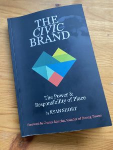
The Civic Brand of Public Engagement
I want to wrap this week’s post with some observations from Ryan Short’s new book The Civic Brand: The Power & Responsibility of Place (MODassic Group, 2025), one of our recommended books for 2026 (mentioned in our post last week, too).
Short expands on the idea of “branding” to encompass the idea of being honest about what your community is, through planning and public policy. He dedicates a good section of the book to the role of community engagement, the illusion of consensus, and getting engagement right.
“A civic brand makes engagement a culture, not a task,” Short writes. “Engagement can’t be a one-off project, and it can’t simply be a task or phase within a project… Engagement is about momentum. Momentum is built through consistent actions and efforts, and therefore it needs to cut across everything, including many things that may initially feel distant” from any one planning or policy project.
A culture of engagement isn’t easy. It doesn’t guarantee “success” however you measure that. “In a good community, people care. In a bad community, they don’t care. In a good community, they show up, complain, and have high expectations, so they continue to push. In a bad community, they don’t show up.”

In Conclusion: Giving People Reasons to Show up
There are a lot of ways to waste time and money on the latest bells and whistles. Chasing the trend will not necessarily be the magic bullet for your community engagement.
We also know if we keep doing the same old things, we’re likely to keep getting the same old results… and even that’s not guaranteed.
This week we covered a range of ideas to spark community engagement. We talked about focusing more on places and less on noise (I do love my maps). We discussed some ideas to me from passive to active participation. We looked at some ideas to improve transparency and trust–issues at all levels of local government, especially these days here in the US. We also touched on how important it is to have an Open Table for public participation. Everybody is welcome.
Now let’s find some new reasons for people to show up in your home town.
Next week we’ll look at putting a community vision into practice. I’m interested to see what that is going to look like!
Resources for Community Engagement

APA Community Engagement Interest Group
The American Planning Association’s Community Engagement Interest Group is an informal, member‑driven community of practice within the APA focusing specifically on elevating public participation in planning and related fields. It provides a collaborative space for planners and engagement practitioners to network, share best practices, and find inspiration around community engagement methods, tools, and ethics. You don’t have to be an APA member to participate.
Practitioners can use the group to find peers experimenting with similar methods of public participation (e.g., participatory budgeting, digital platforms, structured dialogue) and to surface case studies that might not yet be in formal publications. Last year, the long‑running EngagingCities community announced that it was merging into the APA Community Engagement Interest Group, with its archive of content and audience.

Books
In addition to Ryan Short’s book The Civic Brand, mentioned above, I’ll repeat these two practical books by my friends Becky McCray and Deb Brown:
- The Idea Friendly Guide: Practical, Immediate Steps to Break Free from Old-Way Thinking and Transform Your Community’s Future by Becky McCray (2025). Temper your urge for extensive process with a practical take on using action to involve the community in building a shared future.
- From Possibilities to Reality: Save Your Small Town with these Uniquely Do-able Ideas, Projects, and Success Stories by Debra Brown (2024). A practical workbook for small town revitalization.
And this one looks useful (at no charge other than your time to read):
- The Art of Hosting Field Guide – Chris Corrigan (PDF download)
A concise, practice‑oriented eBook widely shared in the AoH network. It introduces the Four‑Fold Practice, core methods (Circle, World Café, Open Space, Pro‑Action Café, Collective Story Harvest), and design tools like the Chaordic Stepping Stones. It is often treated like the “starter book” for new hosts because it combines philosophy, checklists, and pattern language in one place.
A few other books related to community engagement that look interesting if not as practical:
- The Heart of Community Engagement: Practitioner Stories from Across the Globe – Laurie W. Wilson (Routledge, 2019)
Uses first‑person practice stories to explore “deep dive” engagement, social field sensing, and links between participatory action research, design thinking, and facilitation. - Digital Twins for Smart Cities and Urban Planning: From Virtual to Reality – Wajid et al. (Routledge-CRC Press, 2025)
Covers concepts and concrete methodologies for using digital twins in urban planning, including data visualization, real‑time analytics, and links to AI and IoT for “living” city models. Good fit for digital‑twin‑as‑engagement‑platform discussions. - Scenario Planning for Cities and Regions: Managing and Envisioning Uncertain Futures – Robert Goodspeed (Lincoln Institute, 2020)
An in-depth examination of scenario planning. Includes chapters on digital tools and participatory workflows for exploring land‑use and transport futures with residents, connecting scenario planning directly to community engagement. - De Gruyter Handbook of Citizens’ Assemblies – Min Reuchamps et al., eds. (DeGruyter 2023)
Comprehensive scholarly handbook covering design, recruitment, facilitation, and impact of citizens’ assemblies in many countries, with chapters on local and urban policy applications. - Participatory Budgeting in the United States: A Guide for Local Governments – Victoria Gordon, Jeffery Osgood Jr., Daniel Boden (Routledge, 2016) — Expensive, check interlibrary loan?
A practitioner‑oriented primer on planning, launching, and managing PB in U.S. municipalities, with multiple city case studies and guidance on administrative design and impact assessment. - Narrative in Urban Planning: A Practical Field Guide – Lieven Ameel, Jens Martin Gurr, Barbara Buchenau (Transcript Publishing, 2023)
A European treatment of planning as “persuasive storytelling” and gives planners concepts and examples for using narrative responsibly to build sustainable, resilient, and inclusive communities. It unpacks how stories frame problems, justify projects, and can either support or undermine equity.
More from JCShepard.com
2026: Bring Your Plans to Life – Monthly Themes Preview
- The New Rural Playbook: Planning Trends That Matter
- Planning with Purpose: Emerging Trends in Rural and Small Town Planning
- Thriving Together: Proven Strategies for Sustainable Rural Economies in 2025
- Wired for Change: Rural America and the Energy Economy of Tomorrow
Check out The 12 Planning & Sustainability Books You Need in 2026 and browse through the Small Town & Rural Community guides on our Resources page.
(As an Amazon Associate, we may earn commissions from qualifying purchases. Check your local library or bookshop, too.)
.